Feeds:
Posts
Comments

Posts Tagged ‘Monday Mad Addict’s Attic’

This season Tremblant is celebrating its 75th anniversary season. Many things have changed since Joe Ryan official opened the ski area on February 12th, 1939.

The quote below is taken from the Frank Elkins’ 1941 The Complete Ski Guide. Here is what is written about Mont Tremblant in the “Where to Ski” chapter, in the Canada, Laurentians section.

Mont Tremblant – Boasts two of the Dominion’s outstanding racing descents, the Kandahar and Taschereau runs, served by one of the world’s finest chair lifts of 4900 feet with a vertical ascent of 1300 feet. Has wide popular appeal, for its exceptional terrain is suitable for both novice and expert. There are at least eight trails and as many open in this vicinity; new Thomas Fortune Ryan intermediate-expert run. New 3500-foot “T-bar” lift to connect with top of chair lift.

Click image in order to access larger version

The map was drawn in November 1939 by G. Lorne Wiggs, Consulting Engineer and is located in The Complete Ski Guide. A few of Tremblant’s original trails remain; trails like Nansen, Père Deslauriers (now La Passe), Sir Edward Beatty (now Curé Deslauriers), Flying Mile and Kandahar, however the original skiers wouldn’t recognize them or the resort 75 years later. The following map list the single chair that was removed in 1980 and marks for future Aerial Ski Chair Lift, instead the Alpine T-Bar was built in 1941 (now Alpine trail). The expansion towards the North side of the mountain was a decade away.

Here are a few important Tremblant dates:
1932 : First Quebec Kandahar race on Kandahar trail
1934 : Old Taschereau ski trail and 1st Taschereau ski race
1938 : Staying at Gray Rocks Inn, Joe Ryan overheard Lowell Thomas and Tom Wheeler of Gray Rocks talk of an excursion to the top of Mont Tremblant. Ryan asked if he could join along. Later that year in start developing Mont Tremblant Lodge. Nansen trail by Jackrabbit Johannsen and supervised by Kare Nansen, son of famous Fridtjof Nansen.
1939 : Ryan opening with a single chair.
1941 : Alpine T-Bar now gives lift access to upper mountain.
1948 : opening of North side with Devil’s River Lodge and three trails (Devil’s River, Lowell Thomas and Sissy Schuss) serviced by another single chair and two rope-tows on the upper mountain.
1965 : Tremblant changes hands. Mary Ryan sells the resort after having managed it since her husband’s passing in 1950. They would be a few ownership changed until Intrawest would arrive.
1988 : First top to bottom lift; Tremblant Express High Speed Quad.
1991 : Intrawest became new owners. In 1993 High Speed lifts are added, the huge Grand Manitou chalet at the summit plus a new part of the mountain is developed; the Edge.
Intrawest became owners in 1991
1999 : development of Versant Soleil.
2009 : Casino opens at the bottom of Versant Soleil.

This Tremblant Base Village is very different from the one that sits at the bottom of the mountain nowadays. Joe Ryan’s vision was an imitation of a typical Quebec rural village; today’s Tremblant architecture is based urban setting: the Old City in Quebec City.

Happy 75th Anniversary Tremblant!!!

Historical information was taken in Frank Elkins 1941 mentioned above, in Louise Arbique’s Tremblant book, Following the Dream and confirmation of some dates in Tremblant 75’s Timeline
((*
*))
((*

Previous Mad Addict’s Attic features on Mont Tremblant:

Mont Tremblant Lodge 1 (1979-80 brochure and prices)
Mont Tremblant Lodge 2 (ski map circa 1973 to 1978)
Mont Tremblant 3 (brochure circa 1984)
Mont Tremblant Lodge 4 (map circa 1953)

Read Full Post »

This season Tremblant is celebrating its 75th anniversary season. Many things have changed since Joe Ryan official opened the ski area on February 12th, 1939.

This month I present the circa 1953 version of the Mont Tremblant Lodge. The previous Tremblant Mad Attic posts have featured the Laurentians resort 1970s and early 1980s versions (see links below).

Mont Tremblant Lodge circa 1953: Tremblant has expanded to the North side with the Devil’s River Lodge opening in 1948 and three lifts.

The essential of this Tremblant Base Village remained the same until Intrawest bought the resort in 1991 and proceeded into redesigning the village. Joe Ryan’s vision was an imitation of a typical Quebec rural village. Today’s Tremblant architecture is based urban setting: the Old City in Quebec City.

There are a few pieces from that era that are still visible. A few of the small chalets have been moved as well as the old day lodge; le Chalet des Voyageurs. The Inn and the Chapel are the only buildings that remains in their original locations. Some of the trails are still there, but most of them have blasted and redesigned. Eleven of the twenty-one trails are still on the map today like the following South side trails:
– Nansen
– Kandahar
– Mi-Chemin (now Charron)
– Ryan’s Run & Lover’s Lane (part of Ryan)
– Flying Mile
– Sir Edward Beatty (mostly Curé Deslauriers)

Most of the North Side trails can still be found:
– Andy Moe & Axel
– Lowell Thomas
– Devil’s River Run
– Sissy Schuss
– Habitant Slope which is possibly part of upper Beauchemin

The first lift, the single chair was replaced in 1980. The Alpine T-Bar disappeared the previous decade and that line became the Alpine trail. The North side single disappeared a few seasons after that first chair. The Upper North side were serviced by two rope-tow where the Tunnel and Rope-Tow trails are now located. People needed to take 3 lifts to reach the summit from the North and 2 on the South; it wasn’t until 1988 that the first top-to-bottom lift was installed.

The following illustrations were drawn by Pierre Cochand and are included in John and Frankie O’Rear 1954 book (reprinted 1988), The Mont Tremblant Story.

Click images in order to access larger versions

Mont Tremblant Lodge
1. Nansen
2. Taschereau
3. Tower
4. Kandahar
5. Mi-Chemin
6. Ryan’s Run
7. Lover’s Lane
8. Standard
9. Flying Mile
10. Sir Edward Beatty
11. St. Bernard
12. Simon Cooper
13. Hans Falkner Slope
14. La Pente Douce
15. Dam Slope
16. Chalet Slope


Devil’s River Lodge
1. Andy Moe & Axel
2. Lowell Thomas
3. Devil’s River Run
4. Sissy Schuss
5. Habitant Slope


1. The Inn
2. The Lodge
3. Chalet des Voyageurs
4. Brook House (Dormitories)
5. The St.Bernard Chapel
6. Staff House
7. Cottages “F” & “G”
8. La Boutique
9. Salon de Beauté
10. Ski Shop
11. Cottage “E”
12. Guest Cottages “F” & “G”
13. Family Chalets
14. One-Room Chalets
15. Stables & Maintenance Buildings
16. Swimming Pool Cottage
17. Swimming Pool

((*
*))
((*

Previous Mad Addict’s Attic features on Mont Tremblant:

Mont Tremblant Lodge 1 (1979-80 brochure and prices)
Mont Tremblant Lodge 2 (ski map circa 1973 to 1978)
Mont Tremblant 3 (brochure circa 1984)

Read Full Post »

Started around 1990, Shames Mountain is a small local area with modest infrastructures, but it’s not about the infrastructures, it’s about the snow and the skiing. The small Northwestern BC ski area with incredible snow and terrain within an easy hike from it boundaries.

Located 35km from Terrace in the Skeena Valley, Shames a small ski area with a slogan of “We love Big Dumps” is drawing attention from beyond the neighbouring communities of Terrace, Kitimat (101km) and Prince Rupert (137km); Vancouver is 1370km drive away The ski area with the 2000 skiers per hour capacity receives an average of 1200cm/year and is only open 5 days a week (Wednesday to Sunday).

The ski area is comprised of 28 runs and glades with 488m vertical drop covering 57ha (147 acres). There is an extra 45ha (111) of natural glades within its boundaries.

Shames is tied in into the community, there is ski bus adults and kids from Terrace to the hill from Friday to Sunday. Not surprisingly that when the previous owners wanted to retire and put the ski area on the market, local skiers came together and formed Friends of Shames (FoS) which eventually became MyMountainCoop in order to buy the mountain with the following vision:

My Mountain Co-op is a community service co-operative with the purpose of providing recreational opportunities via the Shames Mountain Ski Area in order to enhance the health and quality of life of the communities in the region that, in turn, contribute to the long-term viability and sustainability of the Co-operative and the ski area.

Read more on the Visions, Goals, Principles of the Coop.

Shames is …

My Mountain Co-op (MMC) is Canada’s first non-profit ski community co-operative. MMC is based in Terrace, BC, serving the northwest region and beyond. Its members represent many walks of life. They are students, tradespeople, professionals, business owners, families, backcountry enthusiasts, and snow-lovers all.

Tenure of the ski area was officially transferred to MMC by the provincial government late in 2012, fulfilling the last condition of the purchase agreement between MMC and the Shames Mountain Ski Corporation.

This month we presented a Trail Map (2006-07?) and brochure from 2008 just as the Shames Ski Corporation

Click image to access larger version


Read Full Post »

White Grass isn’t an alpine ski area with lifts; it’s a cross-country and backcountry ski area. The place was highly recommended when we were heading down to Canaan Valley, West Virginia, last October for the Frankenstorm 3 feet dump.

One small building and inside was a trip back in time. Rental equipment, lunch room, kitchen: it reminder me of a rustic sugar shack setting with ski gear. The rural setting and scenery of the place reminded me parts of Vermont or rural Quebec.

Anyhow, here is the description found on the ski map picked up during last year’s epic trip:

Welcome
White Grass is situated on over 2,500 acres of private, state, and federal lands within the Cabin Mtn. range of West Virginia’s high Alleghenies. We pick up much of our snow off the Great Lakes whenever strong north-westerly winds drop out of Canada. Originally built as the Weiss Knob Ski Area in 1959, Bob and Anita Barton operated 4 rope tows and had snow making here. The Randall Reed family owns much of the property we ski upon and we thank for allowing us to do so.

– Groomed Trails (25km)
– Snowfarming (“5 km of snowfence and driftlines are maintained adjacent to the lodge”)
– Telemark Glades (“the largest and steepest system around. Fly down the Yitzhak Ravine, Boutros-Boutros Gully or jump the Yessir-Yessir – Air is Fat!”)
– Snowshoes

Our Mountain & the Canaan Valley
– 40 trails totalling 50 km
– 1196′ vertical: 3240′ – 4434′
– Average Snowfall 150″
– Average Skiable days at 4000′: 95
– Best skiing mid January – early March

Here is the 2011-12 Trail Map for White Grass:

Click to access larger image

White Grass’s website
Ski Mad World TR :Frankenstorm Trick and Treat, West Virginia style – Part 2 : White Grass, Nov 1, 2012

Read Full Post »

Just a few months ago, Monday Mad Addict featured the unique Mont Alta which had fallen on hard times. The future was indeed uncertain for the quaint Laurentians ski area located in Val David. After 3 consecutive bad years, last season was finally a good snow season north of Montreal, however Mont Alta didn’t open in 2012-13 due to a number of circumstances. The long time owner Osward Lingat has recently put the ski area on the market, but something has happen in the last few months. Behind the scenes, some people couldn’t accept to let Mont Alta become just another lost ski area. In their eyes, Mont Alta is too unique, too special not to go everything possible to save it. But first, the mountain has to open for the coming season.

Taken from the Mont Alta website:

YES, Mont Alta will be in operation this winter (2013-14)! ALTHOUGH…

As many of you may already know, the Mont Alta is for sale, since March 2013. Our goal is to form a cooperative to acquire it, so we can preserve the mountain and its history! We are currently looking for investors who are willing to give time, energy and… money so we can all claim the land to be ours again! If you are interested into being part of Mont Alta’s rebirth, please fill in the following form. We will be in touch with you very soon.

Ski Mad World will also post more on the subject in the coming weeks.

Further information on the project on Zoneski : And what if we bought back Mont Alta?

In its 10 years of existence, the Quebec ski forum Zoneski has encouraged people to explore some of lesser known ski areas like Mont Alta. This week we feature the 2006-07 Mont Alta ski brochure that was produced with their help. Although Zoneski isn’t in the market to buy a ski area, it represents the Quebec skiing community and helping people get-together for this venture.

Click to access larger image

Mont Alta is a special place. Here is what SBC Skier had to say about the Val-David ski area.

Mont Alta is the last vestige of the ski-wherever-you-damn-well-please attitude (…) no fake snow here, no grooming and no highway flattop. There are also no beautiful people, fake tans, or bad skiers. Off-limits at Alta is governed only by fear and inability. Jutting branches and rock cliffs are teaching tools, and come dump time, powder piggies line up for first tracks and snort to their heart’s content.

Source and further information :
Visage du ski: Oswald Lingat by Geneviève Larivière / Zoneski
And what if we bought back Mont Alta? by Christophe Deschamps / Zoneski
Qui a piqué la cloche du Mont Alta? by Geneviève Larivière / Zoneski

Monday Mad Addict’s Attic : Mont Alta, Québec

SBC Skier (Oct 2008) Mont Alta, Val David QC by Sandy Wolofsky
Point de Vue Laurentides (April 2013) : “Je ne suis pas un millionnaire” – Oswald Lingat, propriétaire du Mont Alta
ZoneSki (2013): Mont Alta, le chant du cygne
ZoneSki (2004-2013): Histoire des stations de ski du Québec – Mont Alta

Read Full Post »

How many ski areas are only open in the Summer time? Passo dello Stelvio located in Italy’s South Tyrol is accessed from the top of the mountain pass of the same name is one of the them. The ski area is only open in the Summer partially due because the road is generally not open from October to May.

Contrary to many other Alps summer operations, this ski area is a one season area and base is very modest in size. The lowest Tram is located at the pass at 2760 meters and connects to Trincerone. Another Tram connects to another station slightly higher at 3174m. From that point, there are a few more drag lifts. Some lodging is available at the pass or that the two tram stations higher in altitude.

Skiing terrain in early summer can reached up to close to 700 meters with skiing from the highest point at 3450m down all the way to the pass at 2760m. All, but one of the ten ski runs are above 3000 meters.

Quote from the ski map:

Una vacanza divesa e indimenticabile!

Ideal for learning and improving technique in all disciplines, from snowboarding and skiing, to off -piste and cross-country skiing. (…) Add to all this a disco, swimming pool, gym, sauna, Jacuzzi…as well as mountain biking, golf and weekly excursions to the Bormio Terme and Giorenza, and you get a unique and unforgettable holiday.

This ski map was taken during my visit in August 2011. Read the Trip Report for description and ski day : Passo dello Stelvio / Stilfserjoch IT : August 28, 2011 – Sci estivo

Click to access larger image

Read Full Post »

The future is uncertain for the quaint Laurentians ski area located in Val David. After 3 consecutive bad years, last season was finally a good snow season north of Montreal, however Mont Alta didn’t open in 2012-13 due to a number of circumstances. The long time owner Osward Lingat has recently put the ski area on the market.

A small piece appeared in SBC Skier on Alta back in 2008 which presented a good description of the place.

Mont Alta is the last vestige of the ski-wherever-you-damn-well-please attitude (…) no fake snow here, no grooming and no highway flattop. There are also no beautiful people, fake tans, or bad skiers. Off-limits at Alta is governed only by fear and inability. Jutting branches and rock cliffs are teaching tools, and come dump time, powder piggies line up for first tracks and snort to their heart’s content.

With an old double chair, people might think that not much has changed at Mont Alta. It ain’t really the case. Skiing started on the slope in 1952 under the name Mont Chevreuil and renamed Mont Alta in the 1970s. In the late 1980s the ski area had 22 trails with two chairlift included a quad and snowmaking. Hard times forced the owner to sell his quad chairlift and stop snowmaking due to the important hydro cost.

This week we presented a ski map that represents that era, vintage circa 1985-1995 which mentioned “22 runs, Snowmaking, Double Chairlift and Quad Chairlift” and indicates multiples parking lots. This map was still being offered, along with recent maps, during my visit in January 2007.

Click to access larger image

MadPat’s TR : Mont Alta, QC – January 29, 2007

Source and further information :
SBC Skier (Oct 2008) Mont Alta, Val David QC by Sandy Wolofsky
Point de Vue Laurentides (April 2013) : “Je ne suis pas un millionnaire” – Oswald Lingat, propriétaire du Mont Alta
ZoneSki (juin 2013): Mont Alta, le chant du cygne
ZoneSki (2004-2013): Histoire des stations de ski du Québec – Mont Alta

Read Full Post »

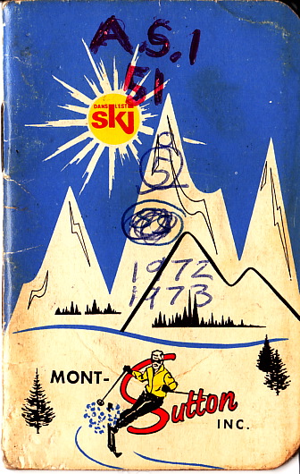
Mont-Sutton Inc. was incorporated under the laws of the Province of Quebec on the 17th day of February 1960.

That is how the small 25-page information/trail map booklet for Mont Sutton started off back 40 years ago. It went on to list the names of the Directors of the ski area at that time.

The small booklet (1″x2″) has been a hallmark of Mont Sutton for many years. This Monday I present you with the 1972-73 version, the oldest that I have, which coincides to the years we skied Mont Sutton before our family started skiing regularly at Mont Tremblant Lodge.

Located on the North side of Round Top mountain, at an altitude of 3,175 feet, Mont Sutton ski area commands the highest Canadian peak within a 100 miles radius from Montreal. Skiers enjoy many facilities including 4 double chair lifts, a T-Bar and a Poma.

Information on the equipment, facilities, Rates, Ski School, Ski Weeks, Church services, season and snow statistics were described in detail in this excellent information booklet.

Mont Sutton’s 1500 feet vertical open on December 17, 1960 and contained 22 runs in the 1972-73 season. The Trail Map was similar to the French system of colours and indicated in details of the difficulty of each part of the trails which might several difficulty ratings.

Rates back in 1972-73 were $7 for full day ticket ($4 for chair III and the T-Bar) and $4 for half-day (9am to 1pm). A season pass set you back for $150 at that time. You could also pay per ride which varied from .30 to .90 according to the lift used. Paying per ride was more common 50 years ago: the public could buy booklet of 30 cents tickets. In fact, some of the old ticket booths are still present at the bottom of a few Mont Sutton lifts today.

The tickets from the booklet, like the Ski weeks tickets, were interchangeable at 6 different ski areas : Mont Sutton, Mt Orford, Mont Echo, Bromont, Owl’s Head and Jay Peak across the border in Vermont.

The Ski School was headed by a former head of the Canadian Ski Instructor Alliance, Canadian Champion and 1960 Olympian. Jean Lessard was Mont Sutton’s first ski school director in 1960, in which he contributed in the design of the first ski trails, headed the ski school until his retirement in 1990. He passed away this April 27, 2013. Stories on Carnet du Ski and Mont Sutton’s website.

Carnet du Ski : RIP Jean Lessard : Le ski québécois perd une légende
Mont Sutton : Mont Sutton’s snow pioneer passed away

Click to access larger image Note the original booklet was 1″ x 2″ in size.

Read Full Post »